ENJOYING THE SILENCE AND BEAUTY OF THE NAUTURE
WINTER HIKING
Walking in the fresh mountain air on prepared winter hiking trails, enjoying the view of the majestic Bietschhorn, stopping for a bite to eat in a mountain restaurant or simply finding new inspiration and strength in the snowy winter wonderland – that’s winter hiking in Unterbäch.
An adventure trail for the whole family
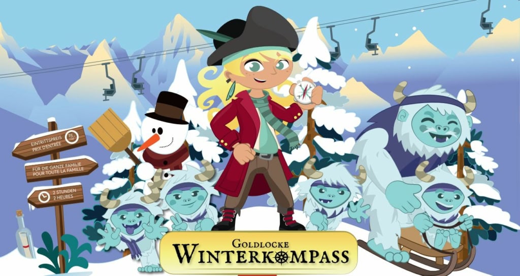
“Goldlockes Winterkompass”
Explore the winter landscape in Unterbäch on foot or by sledge with Goldlocke. The treasure hunt begins at the valley station of the Unterbäch-Brandalp chairlift. Goldlocke’s winter compass was damaged in a storm. Now it’s up to you to find the necessary parts and repair the compass. Head to the valley station of the Unterbäch-Brandalp chairlift to get a map and start your adventure.
The adventure trail is open from the start of the Unterbäch Sportbahnen season on 20 December 2025 and closes at the end of the season on 29 March 2026. The duration of the trail is around 3 hours (excluding lunch break). Enjoy the pirate menu in the Alpenrösli restaurant on Brandalp, or in the Alpenhof restaurant.
And if the toboggan run is closed? No problem, an alternative route via the chairlift with an additional post at the car park still guarantees an unforgettable experience.
Give the gift of an unforgettable winter adventure with the voucher for Goldlocke’s winter compass!
| Price per child | |
|---|---|
| Adventure trail | CHF 11.00 |
| plus sledge | + CHF 2.00 |
| plus chairlift (one-way) | + CHF 7.00 |
| plus pirate menu | + CHF 13.00 |
| plus return chairlift (if the toboggan run is closed) | + CHF 11.00 |
Tip
ENJOY THE SILENCE AND BEATY OF NATURE ON FOOT
Unterbäch-Circuit
Probably the most popular winter hiking route leads from the village of Unterbäch, via the popular Brandalp up to sunny Ginals. And if you prefer a more leisurely pace, you can complete one or more sections on the chairlift, depending on your preference.
THE MOST POPULAR WINTER HIKING ROUTE IN UNTERBÄCH
The winter hiking trail leads from Unterbäch up the toboggan run to Brandalp. From there the trail continues via Breite Stäg to Unner Sänntum. Fortify yourself on the way with hearty mountain hut fare in the Alpenrösli restaurant on Brandalp or in the Ginals restaurant in Unner Sänntum.
Tip: The hike can be shortened as desired with the Unterbäch – Brandalp and Brandalp – Breite Stäg chairlifts.
TOUR DETAILS:
- Hiking time: 3h 30 (↑883m ↓106 m)
- Route: Unterbäch – Brandalp – Breite Stäg – Unners Sänntum
- Length: 10.75 km
- Technical difficulty: easy
- Physical fitness requirement: medium
Tip
WINTER HIKING WITH A PANORAMIC GUARANTEE
Panorama trail with Milibach suspension bridge
The panoramic winter hiking trail connects the five municipalities of Törbel, Zeneggen, Bürchen, Unterbäch and Eischoll via a prepared hiking trail. The approximately 18 km long winter hiking trail takes around 5 hours 30 minutes to complete.
Our tip:
Take the Unterbäch-Brandalp chairlift to the start of the panoramic winter hiking trail. The route to Eischoll, Strygge takes around 1h 40 (6.3 km, ↑217 ↓250), where you can take the chairlift to the village of Eischoll. The villages of Eischoll and Unterbäch are connected by the Milibach suspension bridge, offering a circular route with guaranteed panoramic views. The tour also works in the opposite direction and can be combined with a toboggan ride.
PROBABLY THE MOST BEAUTIFUL WINTER HIKING TRAIL IN SWITZERLAND
The panoramic winter hiking trail leads from Törbel, via Zeneggen, Bürchen and Unterbäch to Eischoll. Lined by the Valais and Bernese Alps, the panoramic view changes every hour. On crackling snow, you hike across the entire Augstbord region between 1,480 and 1,800m above sea level from mountain village to mountain village. A unique experience high above the Rhone Valley. The approximately 18km-long winter hiking trail is groomed with snow groomers during the winter season. It is also laid out in such a way that only parts of it can be completed. The individual villages can be reached by public transport.
TOUR DETAILS:
- Hiking time: 5h 30 (↑543m ↓547 m)
- Route: Furen (Törbel) – Diepja – Obere Hellela (Zeneggen) – Bodmen (Bürchen) – Wiisapji – Brandalp (Unterbäch) – Breite Stäg – Seewustafel – Striigge (Eischoll)
- Length: 18km
- Techncal difficulty: easy
- Pysical fitness requirement: medium

